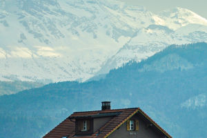
In recent years, the topic of global warming has been a concern by the public, and the accelerated melting rate of snow-capped mountains has proved that global warming is coming into reality, such as Mount Muztag.
Mushtaq Peak is located at the junction of Aktao County and Tashkurgan Tajik Autonomous County in Xinjiang Uygur Autonomous region of China.
With an elevation of 7509 meters (7546 meters above sea level).
Its majestic and tall body stands tall on the Pamir Plateau.
The glacier hanging upside down is like a silver beard fluttering on the chest, so it has the laudatory name of "the father of icebergs".
The hottest month of the year in Xinjiang is July.
Every July, the snow on Mount Muztag in Xinjiang melts.
Compared with the melting of snow on Mount Muztag in July this year, the surface area exposed after the melting of the snow mountain in July this year is significantly larger.
However, the snowy mountain images of last year and July of the year before last did not change significantly.
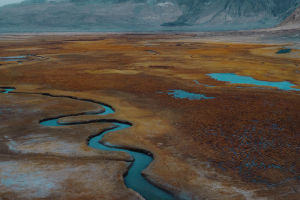
The rivers under the melting of snow-capped mountains are composed of rainfall, melted water and groundwater.
As the water accumulates more and more at a certain location, it begins to flow to low-lying places.
In the process of flow, there is a continuous confluence of new Rain Water, groundwater and small streams.
After a long period of erosion of the soil, and finally formed a river.
If you look at these rivers from a higher point of view, you will find that they all show a curved shape, why is this shape?
First of all, the bending of the river needs an opportunity, that is, the riverbed itself is partially bent because of some factors.
Generally speaking, there are three influencing factors:
First, the influence of topography.
The terrain is not flat, some rivers flow through the place, the terrain is undulating, the river will become curved.
Second, biological disturbance.
Rats, rabbits, snakes and other creatures will make holes in the shore.
Don't underestimate these little caves.
If the river rushes into the mouth of the cave, it will widen the gap little by little, eventually causing the riverbed to tilt.
Third, geological factors.
Cracks and faults in the strata will bend the river.
When a concave and convex bank is produced because of the above three factors, the twists and turns of the river officially begin.
The water velocity in the river is uneven, and the flow speed in the middle of the river is the fastest.
When there is a bend in the river, the fastest part of the water hits the bank directly ahead.
Which increases the local water pressure on the concave bank, forming a spiral circulation inside the river, which further erodes the concave bank and accumulates the washed sand and gravel to the convex bank.
In the long run, the bending will become bigger and bigger, and the water coming out of the curve will impact the downstream bank with a certain lateral impact force.
However, things will turn around at the extreme, and the river will become more and more curved, and eventually it will change from curved to straight one day.
When sand and gravel continue to accumulate towards the convex bank and the concave bank is constantly eroded.
Eventually the river bend will gradually become independent and become a small lake, and the original river will be cut straight and become straight again.