Unlike the surface rivers that rush day and night, the underground rivers are kept in darkness all year round. So few people have seen their whole picture.
Underground rivers are defined geologically as rivers that submerge below the surface in karst-developed areas and flow along underground caves.
The formation of every geological form is accompanied by a long evolution process, and the same is true for underground rivers.
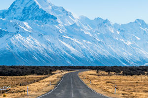
The emergence of underground rivers is always "inseparable" from karst because underground rivers are formed by the flow and discharge of groundwater in karst areas.
In the beginning, groundwater flows along tiny cracks. With the continuous erosion of water flow, the fissures gradually expand and form underground tunnels.
With the passage of time, the amount of groundwater continues to increase, the flow rate accelerates, and the dissolution and erosion effects are also increasingly strengthened. The underground tunnels are further developed into underground pipes or passages.
When the underground channel and groundwater flow develop to a certain extent, the groundwater flow can develop into an underground river. And the river section can be as long as more than ten kilometers, and some can even be sailed by boat.
Large underground river systems can form underground water systems, and some drainage areas can reach more than 1,000 square kilometers. Eventually, the flow of the underground river flows directly into a nearby surface river.
The shape of underground rivers is affected by geological structures. According to their morphological characteristics, underground rivers can be divided into dendritic underground rivers, jagged underground rivers, linear underground rivers, and network underground rivers.
Have you ever been to the Subterranean River National Park? The scenery is very beautiful!
Puteri Harbor Underground River National Park is one of the world's new seven natural heritage sites and the world's longest underground river that can be used for boats.
Each person holds a multilingual interpreter while admiring the unique stalagmites and stalactites while listening to the audio guide telling interesting stories. Reminding everyone to respect nature, and care for the environment.
After about an hour of sightseeing, you will have a buffet lunch at Sabang pier before heading back to Puerto Princesa city center. A must-experience nature tour in Palawan!
Princesa Subterranean River National Park is located in the Sao Paulo Mountains on the north coast of Palawan Province, Philippines.
The park faces St. Paul's Bay in the north and the Babuyan Strait in the east. The park has an 8.5-kilometer underground river that can be used by boats.
It flows through rugged, wrinkled carboniferous rocks, marble walls, and magnificent caves, and then flows into the South China Sea. Because of its rich and precious primitive natural ecology, was listed as the world's natural inheritance in 1999.
Due to the length of the waterway, the exploration inside the cave takes 45 minutes to complete.